The Cuyahoga County Planning Commission, the Cuyahoga County Department of Public Works, SmithGroup, and our lakefront communities are embarking on a project to determine where public access to Lake Erie can be expanded. This page is dedicated to information directly for owners and associations whose property directly abuts Lake Erie. As part of a vision for improved lakefront access, the input and buy-in of lakefront property owners is vital before any steps can be taken.
Letter of Interest
If you're a lakefront property owner and you're interested in submitting a non-binding Letter of Interest, please complete this form or contact us via email.
Sample Letter of Interest (Please send completed Letters of Interest to info@countyplanning.us.)
Interactive Map
Is your property within an area of interest identified by the project team? Use this mapping tool to find out. Segments in green have been identified as focus areas, segments in orange are high-priority areas, segments in dark red are a medium priority, and segments without shading are a low priority at this time.
Public Meetings
Two property owners meetings were held virtually on January 12 and January 14, 2021.
Meeting #1: January 12, 2021 (East Side)
Meeting #2: January 14, 2021 (West Side)
Download the presentation
Property Owner FAQs
Below are answers to frequently asked questions regarding erosion and lakefront access, and what it might mean for property owners.
If Public Access Were Allowed Along My Shoreline…
- Who would be responsible if someone were injured while walking the shoreline trail along my property?
Details on maintenance and liability will be addressed in future specific agreements worked out with private landowners. However, private landowners would not be responsible for maintenance and liability. - Would I give up ownership of my shoreline property?
Private landowners do not need to give up their property to allow for development of public access and shoreline protection. In some instances, private landowners may elect to donate lakefront property. However, we anticipate that a majority of the improvements would be built on lakefront easements. - Do my neighbors have to allow public access too?
No. However, investment in public access and shoreline stabilization on a parcel by parcel scale is not typically overly effective, can be costly, and can make it more difficult to construct. Investment is likely to be directed to areas of shoreline where multiple property owners are interested in potential public-private partnership toward expanded public access and shoreline stabilization. - I have improvements like a boathouse or dock along my shoreline, what would happen with those?
Public access and private shoreline improvements may occur on the same parcel. Detailed discussions with individual landowners will occur as part of future project phases to address unique situations. - Who would pay for the cost of the erosion control and public access improvements?
As noted in the General FAQ , funding for recommendations identified in the Lakefront Public Access Plan is likely to include a variety of different sources. - How long would the public access and shoreline protection improvements remain on my property?
The length or term of the agreement would be established as the project advances. Shoreline improvements typically require approvals by state and federal agencies and come with a fifty (50) year duration. Allowances for modification to the duration to either lengthen or shorten the term would be set forth in specific agreements with landowners as part of future project phases. - How would public access affect me economically?
Economic impacts are difficult to quantify and can be interpreted in many ways. For landowners whose properties exhibit significant erosion concerns – specifically those where there is concern over damage to existing buildings – property values may remain stable or increase. In the example of Euclid, many private lakefront landowners have indicated that their property values have not changed since completion of the western phase of that project.
What would public access look like?
- The West Side has significantly different topography than the East Side. What would public access look like on the West Side?
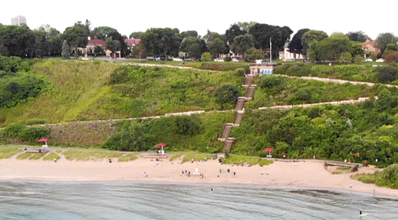
Public access and shoreline protection will vary based on public input, landowner perspectives, and the site-specific conditions. Bluff height, local geology, the relationship between existing buildings and the bluff, depth of water and exposure to waves are all influential factors as well. Elevated pile supported boardwalks, trails with paralleling shoreline stone revetments, cantilever walks, and beaches are all possible elements for providing access and shoreline protection. These details will be evaluated as the project advances. Images that illustrate potential ideas that may be explored were included in the public meeting presentation given on January 28, 2020.


- How will safety be ensured along lakefront trails? What time will they be open?
Safety for the public and landowners is important. Trails, like sidewalks in a community or public parks, are safest when other people are present. The approach to addressing safety concerns will likely vary along the lakefront and within different communities. Hours of operation are also likely to vary from city to city. In the case of Euclid, the lakefront trail hours of operation are the same as the public parks. Many of Euclid’s lakefront landowners who provided the easements retain ownership of the lakefront and are permitted to access it anytime as they can with other portions of their property. These details will be addressed within future agreements developed with lakefront landowners as the project moves ahead. - How will the public using the trail be limited from accessing private property?
Where bluffs exist, grade separation or placing the trail partway down the bluff is one strategy. Barriers such as railings and gates, signage, and landscape treatments are options as well. The appropriate approach or solutions will vary based on the specific site conditions and will be discussed with lakefront landowners as the project moves ahead. Images that illustrate potential ideas that may be explored were included in the public meeting presentation given on January 28, 2020.


- How would lighting be incorporated into the project?
Lighting options will be determined as the project moves ahead and with landowner and public input. Options could include overhead lights, bollard, or ground mounted low-level lights. The need for, type, location, and presence of lighting are important considerations to be determined during future project phases. - Will ground water and stormwater be considered as part of this plan?
Yes. These factors are all important considerations and are part of detailed studies that will be completed as the project moves ahead. - Are there already plans for existing areas you can share?
No plans currently exist. Public and landowner perspectives, as well as the specific site conditions present along the shoreline need to be understood prior to developing plans. - How will projects or priority areas be determined?
Landowner interest in partnering with the County and public interest in having expanded public access along segments of the lakefront are key factors. Other probable factors include things like the severity of erosion, connectivity with existing trails and public access points, existence of little current public access, and complexity of permitting.
How will this process work?
- How can we hear more specifics about how this project would affect my property?
Not all publicly or privately owned lakefront property within the County will be included in the project. For those shoreline segments included in the project, more specific information and details will be discussed as the project advances. Properties included in the project are anticipated to be determined by the summer 2021. - I have questions. Can you come talk to my neighborhood group/street/block club/association?
Questions about the project can be submitted via the comment form at the bottom of this page. You may also contact County Planning at info@countyplanning.us to discuss the project in more detail and to potentially set up a time to meet. - What should I be doing now to advance this project?
Remaining engaged in the process is key. Advancing a project of this scale requires ongoing involvement and support. Responding to surveys and talking with neighbors and other residents throughout the County can also be beneficial. Some landowners and associations have sent letters of interest and support directly to the County as well. - My neighborhood is forming a SID. Should we stop?
No. The County is recommending lakefront landowners continue advancing ongoing initiatives such as SID formation. Not all publicly or privately owned lakefront property within the County will be included in the project. - I have already made investments in my lakefront property. Can I be reimbursed? How would existing investments be handled?
The type of improvement, how the improvement was designed and built, and many other factors would influence such a decision. This initiative is intended to provide mutual benefit – both for the public and private landowners. Improvements would need to benefit both groups at a minimum. Please contact us using the comment form at the bottom of this page or email County Planning at info@countyplanning.us to provide additional details or to set up a time to discuss your specific situation.