Our recent work covers a broad spectrum of planning projects. County Planning staff have completed plans, studies, and initiatives at community, county, and regional scales. Below are some featured projects exemplifying the range and depth of our professional planning services. Contact us to discuss how we can help advance your planning process.

Cuyahoga County Unified Zoning Code
County Planning is developing an opt-in zoning ordinance that modernizes regulations and unlocks development opportunities, while maintaining local administrative authority.

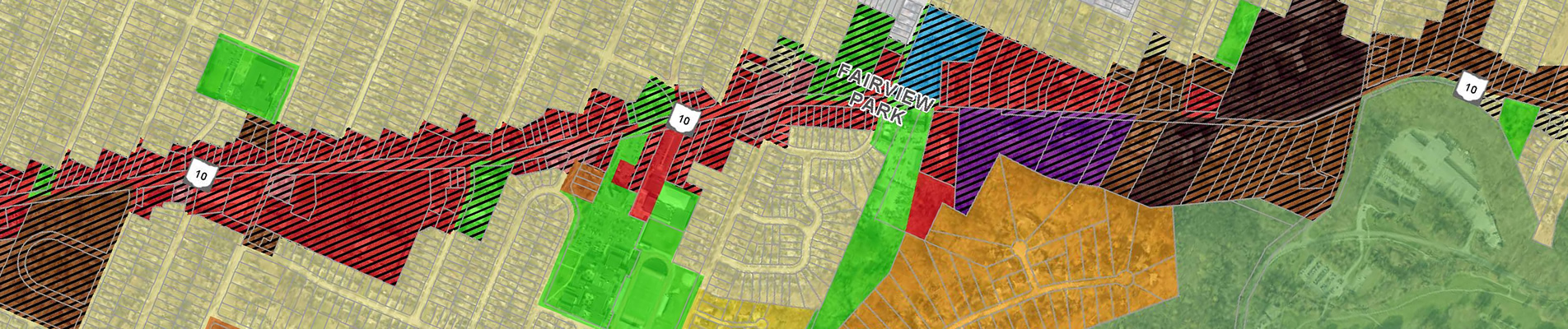
Fairview Park TOD Overlay Zoning Code Update
County Planning has partnered with the City of Fairview Park to create a Transit-Oriented Development (TOD) Overlay Zoning District.

Bedford Master Plan
The City of Bedford's new master plan will reflect current community desires, adjust to new market conditions, and create a vision for areas of opportunity.

Valley View Master Plan
For the first time in nearly 25 years, the Village of Valley View is undertaking an effort to create a new Master Plan—one that reflects the community's current needs, evolving demographics, and future aspirations.

East 22nd Street Current Conditions Assessment
The East 22nd Street Current Conditions Assessment coordinates many concurrent, highly consequential planning efforts by a wide variety of stakeholders within a small area of significance to the City of Cleveland.
Cuyahoga County Parking Analysis
The Cuyahoga County Parking Analysis provides an overview of parking regulations across 29 local communities and includes a series of best practices to guide communities toward minimizing the adverse impacts parking lots have on development.

SS4A: Cuyahoga County Comprehensive Safety Action Plan
The Cuyahoga County Comprehensive Safety Action Plan will outline steps to develop a safe transportation network and empower our communities and transportation agencies to make changes that reduce crashes.
Cleveland Heights Gateways & Wayfinding Signage Plan
The Cleveland Heights Gateways & Wayfinding Signage Plan will develop a coordinated strategy for gateways and wayfinding to help residents and visitors navigate the community.
North Olmsted Mall Area Mixed-Use Overlay District
County Planning is worked with the City of North Olmsted to create a Mall Area Mixed Use Overlay District for the Great Northern Mall area.
Evolving Southgate Area Redevelopment Plan
The Evolving Southgate Area Redevelopment Plan identifies redevelopment recommendations for the areas in and around Southgate in the City of Maple Heights.
Highland Hills Comprehensive Plan
The Highland Hills Comprehensive Plan updated the Village's community goals and objectives to reposition Village to better align with future opportunities
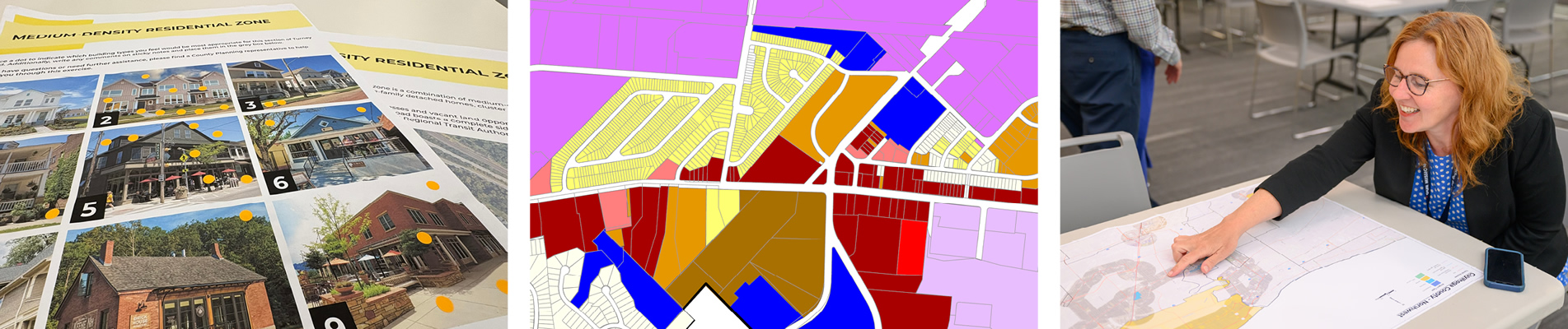
Turney Road Transit-Oriented Development Study
The City of Garfield Heights and County Planning, in coordination with GCRTA, conducted a study along Turney Road to evaluate the corridor's potential and readiness for transit-oriented development.
Transit-Oriented Development Zoning Study
The TOD Zoning Study aims to improve zoning regulations and governmental policies in order to attract more transit-oriented development to key corridors in Cuyahoga County.
Single-Family Zoning Analysis
The Single-Family Zoning Analysis aims to identify issues within zoning and outline best practices for making the construction of desired infill housing more practicable.
Cuyahoga County Lakefront Public Access Plan
The Cuyahoga County Lakefront Public Access Plan aims to build a comprehensive vision for better connecting our residents to our Great Lake.
Cuyahoga County Greenprint
The Cuyahoga County Greenprint is an interactive suite of mapping and planning tools for preserving and enhancing the County's natural features, recreation areas, and greenways.