
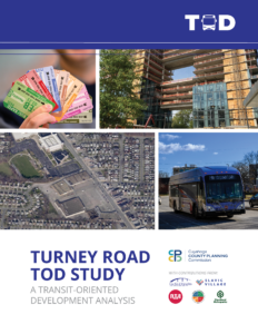
The City of Garfield Heights and the Cuyahoga County Planning Commission, in coordination with GCRTA, conducted a study along Turney Road to evaluate the corridor’s potential and readiness for Transit-Oriented Development (TOD).
The study produced strategic implementation strategies and targeted redevelopment scenarios for future consideration. These efforts stem from the Transit-Oriented Development (TOD) Zoning Study, which aims to improve zoning regulations and governmental policies in order to attract more transit-oriented development to key corridors in Cuyahoga County.
Documents
Turney Road TOD Study
The completed Turney Road Transit-Oriented Development Study is available for viewing and downloading. The City of Garfield Heights officially adopted the plan on November 24, 2025.
Meeting Materials
City Council Meeting (October 27, 2025)
Project Open House #2 (April 9, 2025)
Project Open House #1 (June 25, 2024)
What Is TOD?
TOD includes a mix of commercial, residential, office, and entertainment centered around or located near a transit station. Dense, walkable, mixed-use development near transit attracts people and adds to vibrant, connected communities.
Current Efforts Supporting TOD
GCRTA identified Turney Road as a Priority Corridor—designated roadways for capital investment in street infrastructure to improve bus speed, reliability, and rider convenience—as part of their 2020 Strategic Plan. These corridors are potential candidates for supporting transit-oriented development through zoning and incentives that encourage density, offer a mix of uses, have reduced parking requirements, and are pedestrian-focused.
Turney Road was also considered as part of the Analysis of TOD Zoning—which identified five (5) key zoning characteristics to analyze the readiness of corridors for TOD: 1) Mixed-Use Zoning; 2) Front Setbacks; 3) Building Heights; 4) Lot Coverage; and 5) Parking Requirements. For each of these five metrics, Turney Road did not meet the criteria established to determine if existing zoning was supportive of TOD. However, this was not dissimilar to other corridors analyzed in this study—indicating a critical lack of TOD-supportive zoning throughout Cuyahoga County, including Garfield Heights.
This study’s efforts to explore TOD on Turney Road are supported and recommended by the City of Garfield Heights Master Plan, which was adopted in 2022. The Master Plan includes a number of zoning recommendations and redevelopment scenarios along the corridor that support TOD and its principles. Overall, the Master Plan identified Turney Road as a prime area for revitalization that is close to Downtown Cleveland, has direct transit access, is walkable, and has a good building foundation to support TOD—with the exception of supportive zoning practices.

Process
The Turney Road Transit-Oriented Development Study aims to not only understand the physical condition of the corridor, but also existing land uses, the exterior maintenance of buildings, and the economic vitality of businesses on Turney Road. The process involved numerous community leaders, regional partners, and local stakeholders, and included four phases:
- Study Initiation: establish the process, responsibilities, roles, and tasks.
- Corridor Profiles: apply multiple analyses to understand corridor readiness for TOD—including Transportation & Infrastructure, Built Form & Land Use, and Business & Economic Profiles.
- Development Scenarios & Recommendations: identify specific opportunities within targeted development areas and outline redevelopment scenarios with recommended strategies for positive growth.
- Implementation Strategy: outline short- and long-term implementation actions and strategies. This phase will also prioritize recommendations and highlight potential partners, funding sources, case studies, and important resources to assist in implementation.
Contact Us
Rachel Novak, AICP
Senior Planner
rnovak@cuyahogacounty.us