
Land as Nature: Ecological and Geological Features
What’s Covered
Land Cover and Tree Canopy display the amount and location of vegetation. These are critical for sustaining clean air and water. Imperviousness displays the amount and location of hard surfaces, impeding the percolation of precipitation into the ground and groundwater systems. Urban Heat Islands identify hot spots or heat sinks which strain human health in hot weather. Elevation and Topography display the shape of land which dictates direction of water flow, erosion potential and even viewsheds.
Overview
Three main components of a given geography drive its characteristics and function: Vegetation, Topography, and Soils (geology). Vegetation is critical, particularly as climate change exacerbates natural processes, for stabilizing land, reducing erosion, moderating temperature and microclimates, enhancing air quality, and supporting wildlife through habitat. “Plants” are the framework of life. The types, quantity and distribution of plants drive the biodiversity and biological function of a region. Topography, expressed as slope, elevation, and soil types, indicates land stability, direction and flow of water, and location of water bodies.
Tree Canopy is becoming increasingly important for improving climate resilience and minimizing heat island effects. Trees are also very desirable for people. Tree canopy is the layer of leaves, branches, and stems of trees that cover the ground when viewed from above. Shrubs and small trees (less than eight feet in height) are excluded from this data set in the Greenprint. The maintenance of existing trees is important to the health of the tree and its canopy. The Ohio Department of Natural Resources Division of Forestry has demonstrated that, over time, maintaining existing tree health is more cost effective than planting new trees. The Cuyahoga County Urban Tree Canopy Assessment studies recommend the adoption of a regular, funded maintenance plan for trees in a community. Additionally, establishing a tree canopy goal is crucial for a community seeking to improve its green infrastructure. The National Forest Service recommends a tree canopy goal of 41% for urban areas, and a goal of 50% or greater in stream corridors and headwaters areas.
Urbanization often brings an increase in hard surfaces, or Impervious cover, which changes watershed hydrology by increasing water runoff volumes. As rain falls on hard surfaces, such as rooftops and parking lots, it often picks up pollutants, delivering them directly to the stream and decreasing water quality. Reducing the amount of impervious cover in a watershed can help improve the water quality significantly.
Achieving the proper ratio of vegetative land to the built environment and the ratio of pervious land to impervious land (measured as percent impervious) is critical for sustaining dense, urban communities of people, like Cuyahoga County. Cuyahoga County encompasses nearly 460 square miles with the following land uses (2019 data): Residential 53%; Parks & Open Space 15%; Industrial 9%; Commercial 6%; Institutional 5%; Transportation & Utilities 3%; Vacant 9%. This balance allows land to both function as nature and also provide natural services, such as flood control, temperature moderation, and high-quality air needed and expected by these urban residents.
Studies conducted by the Center for Watershed Protection (Impacts of Impervious Cover on Aquatic Systems) show a correlation between impervious cover and stream degradation. The chart below aggregates the results of these studies including the finding that an impervious cover greater than 25% can significantly damage stream functions and reduce water quality. Although every stream has a different threshold, these universal findings demonstrate a pattern and correlation.
| Percentage of Impervious Cover | Level of Impact | Water Quality |
| 0-10% | Sensitive | Good Water Quality Supports Aquatic Life |
| 10–25% | Impacted | Marginal Water Quality Can support aquatic life |
| Greater than 25% | Damaged | Poor Water Quality Channel eroded or modified Limited aquatic life |
Heat Islands are urbanized areas that experience higher temperatures than outlying areas. Structures such as buildings, roads, and other infrastructure absorb and re-emit the sun’s heat more than natural landscapes such as forests and water bodies. Urban areas, where these structures are highly concentrated and greenery is limited, become “islands” of higher temperatures relative to outlying areas. Daytime temperatures in urban areas are about 1–7°F higher than temperatures in outlying areas and nighttime temperatures are about 2-5°F higher (USEPA). These, in turn, contribute to heat-related deaths and heat-related illnesses. An EPA review of several studies found that some communities in the United States, particularly those that are low-income and with higher populations of people of color, have neighborhoods with higher temperatures relative to adjacent neighborhoods in the same city. The studies identify historic redlining as a contributing factor. Specifically, people of color and community members with low incomes are more likely than other groups to live in historically redlined neighborhoods that are present-day intra-urban heat islands.
When disturbed, Steep Slopes can collapse into rivers and disrupt natural systems causing flooding and harming plant and animal life. Sloughing and collapsing slopes can damage buildings and other structures, even structures built on flat plateaus above a sloping valley. A hillside or slope is considered steep if its gradient is 12% or greater. Hillsides offer important view corridors (viewsheds) and access to significant and scenic landscapes. Hillside preservation is an important component to a healthy environment and maintaining property values. Hillsides will often have unique ecosystems with plants specific to that land gradient and directional aspect (northern exposure vs. southern exposure, etc.) that have remained relatively untouched because of impediments to development. In many cases, property owners at the summit of a hill have beautiful, scenic views of other property which is not their own. They experience and benefit from what is called a “borrowed landscape.” Property beneath them or in the opposite valley may be altered through development and construction of buildings that change these views. Equitable development restrictions and balanced growth planning can be used together to serve the public good and needs of the community.
Importance and Value
 Trees and soils function together to reduce stormwater runoff. Trees are living water towers and they rapidly soak up stormwater.
- Trees help minimize flooding and improve water quality.
- Trees are critical to climate resilience. They help moderate temperature as windbreaks, through shade, and through evapotranspiration, the transport of water plants to the atmosphere, thus reducing the urban heat island effect occurring in city centers.
- Trees remove many pollutants from the atmosphere, including nitrogen dioxide (NO2), sulfur dioxide (SO2), ozone (O3), carbon monoxide (CO), and particulate matter (PM) of 10 microns or less (PM10).
- Trees reduce greenhouse gases through the uptake of atmospheric carbon.
- Trees provide diverse habitat, food, and nesting sites for a wide variety of wildlife.
- Contiguous areas of vegetated land, particularly woodlands, are more beneficial than individual fragments for habitat and provide a wildlife buffer between habitat and residential and commercial areas.
- Steep hillsides are prone to soil erosion, especially when disturbed, which can damage waterways.
- Destabilized steep slopes can greatly affect stormwater runoff and lead to significant flooding issues.
- Hillside slippage can cause property damage or a reduction in property values due to loss of land.
- Reducing heat islands can improve energy efficiency of buildings.
- Reducing heat islands can enhance air quality and reduce Greenhouse Gases.
- Reducing heat islands can improve water quality.
 Trees and soils function together to reduce stormwater runoff. Trees are living water towers and they rapidly soak up stormwater.
Recommendations for Communities and Landowners
 Protect the existing tree canopy, especially in stream headwaters areas.
- Adopt a tree plan that includes tree planting, maintenance, and tree removal standards, guidelines, and policies.
- Adopt a tree replacement policy to ensure that whenever a tree is removed, it will be replaced.
- Consider a tree removal permit system.
- Consider a recompense policy for historically significant or other identified specimen trees in case of harm.
- Adopt development guidelines that require and define tree placement for new construction activities.
- Fund a municipal tree maintenance budget.
- Retrofit parking lots with trees or make tree islands and street trees a part of city code or design guidelines.
- Encourage, and consider incentives for, private property owners to plant and maintain more trees, especially in privately held plant-able areas.
- Develop citywide plans and practices to minimize the spread of tree diseases and tree killing insects such as the Emerald Ash Borer and Asian Longhorn Beetle and replace affected trees with a diverse palette of resistant species.
- Adopt landscaping design standards for trees within commercial and industrial properties.
- Ensure that landscape design and planting requirements are environmentally and species appropriate to optimize the health and long-term survival of new plantings.
- Identify areas which could expand or connect forest patches and determine the practicality of planting more trees in these areas.
- Develop programs that educate residents on tree stewardship and provide incentives for tree planting and maintenance of forest patches on private property.
- Conduct an engineering assessment of slopes and soils on a community-wide basis as part of a comprehensive plan.
- Determine the types of soils present and integrate this information into slope restrictions and requirements.
- Establish Hillside Protection Zones.
- Expand stream setback requirements based on degree of adjacent slope, or slope analysis including slope length, soil erodibility, and existing vegetation.
- Restrict construction on ridge lines.
- Establish design requirements or standards for new construction and building renovation on size, shape, orientation, and aesthetic look of structures in order to protect views and vistas.
- Encourage innovative planning, design, and construction techniques for development in hillside areas.
- Restrict mass grading of slopes or require “contour or landform grading.”
- Limit vegetation removal, especially on hillsides.
- Require buffers for steep slopes to limit hillside disturbance.
- Expand stream buffers in steep slope areas.
- Establish Green Building and zoning standards and weatherization standards for your community which require the integration of vegetation and energy conservation in residential, commercial, and industrial development.
- Increase shade around your home to reduce heat island effects.
- Install “green” or “cool, reflective” roofs.
 Protect the existing tree canopy, especially in stream headwaters areas.
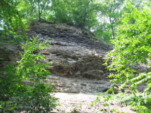 Establish design requirements or standards for new construction and building renovation on size, shape, orientation, and aesthetic look of structures in order to protect views and vistas.
Resources for More Information
- U.S. Forest Service Urban and Community Forestry – resources and publications on trees, insects and diseases, “Greening your Community” and more.
- Forest Service Open Space Conservation Strategy– outlines national priorities to help the Forest Service be a more effective partner in open space conservation to ensure that forests and grasslands across the landscape can continue to provide valued services and benefits. Includes a downloadable report.
- Landscaping for Biodiversity with Ohio Native Plants: A Species Guide for Plantings
- Cuyahoga County 2019 Urban Tree Canopy Assessment Update – a snapshot of the county’s tree canopy and land cover including:
- The Downloads section provides GIS and spreadsheet files for several levels of geography, as well as links to web map services. The downloadable data sets provide significant detail on acreage and percentages of the available land cover measures.
- For background on the topic of urban tree canopy assessments, see the Conclusions section, which includes links to additional resources.
- The Cleveland Tree Coalition and Plan – Goals and action steps
- ODNR Division of Forestry Urban Forestry – Community Assistance programs and resources
- Tree City USA – a program of the Arbor Day Foundation that is administered in Ohio by the Ohio Department of Natural Resources Division of Forestry. Ohio program
- Cuyahoga County Climate Change Action Plan – an effort to set targets for greenhouse gas emissions reductions, implement and track actions to meet targets, and adapt to climate change across Cuyahoga County
- The Center for Watershed Protection – an organization founded to protect and restore streams, rivers, wetlands, lakes, and bays. Numerous resources are available on its website. An Integrated Framework to Restore Small Urban Watersheds (2005)
- Balanced Growth Ohio – an initiative of the state of Ohio that encompasses a voluntary and incentive-based strategy to protect and restore Lake Erie through linking land use planning to the health of watersheds. Visit the website for best local land use practices, including a chapter on steep slope protection
- OEPA Standards for stormwater management, land development and urban stream protection. Chapter 7 of this document, Soil Stabilization, provides specific recommendations for stabilizing soils
- ODNR Coastal Management Program provides guidance on erosion prevention (search for “erosion”)
- NOAA Living Shorelines describes living shoreline techniques for shoreline stabilization
- Chagrin River Watershed Partners Model Ordinances for Erosion and Sediment Control – is a document with several examples of model ordinances provided by Chagrin River Watershed Partners
- USDA Web Soil Survey – provides soil maps and data available online for more than 95 percent of the nation’s counties
- National Integrated Heat Health Information System initiative
- USEPA Heat Island Effect website with dozens of links to detailed subtopics
Top photo by Jason Cohn, courtesy of the Rails-to-Trails Conservancy