In coordination with the Cities of Cleveland and Lakewood, County Planning is conducting a plan along W. 117th Street to explore multi-modal improvements and redevelopment opportunities.
The W. 117th Street Corridor Plan aims to understand the corridor’s challenges and opportunities to make targeted recommendations that support multi-modal transportation, development, and infrastructure investments.
Project Background
W. 117th Street is a major residential, retail, and industrial corridor connecting established residential neighborhoods and key commercial and industrial nodes. It is also an important transit corridor that was designated as a Long-Term Priority Corridor in the Greater Cleveland Regional Transit Authority (GCRTA) 2020 Strategic Plan . These Priority Corridors were targeted for capital investment in street infrastructure to improve bus speed, reliability, and rider convenience, while encouraging transit-oriented development that can support additional transit ridership.
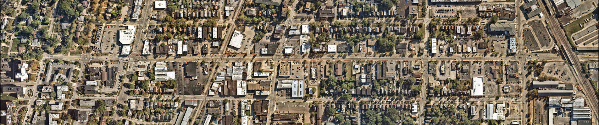
This plan will focus on a 1.1-mile stretch of W. 117th Street—from Edgewater Drive near the lakefront down to Berea Road—located along the border between Cleveland and Lakewood, anchored by the W. 117th – Madison Station.
This study will explore issues and opportunities related to:
- Roadway conditions and configurations
- Bicycle and pedestrian connections
- Transit access
- Overall corridor safety
- Development opportunities
Project Process
The W. 117th Street Corridor Study is being conducted through a partnership between County Planning and the Cities of Cleveland and Lakewood, in coordination with the Greater Cleveland Regional Transit Authority (GCRTA) and the Cuyahoga County Department of Public Works. This project kicked off in August 2026 and is expected to be completed by July of 2028. Key phases include:
- Corridor Profile: Outline current trends and conditions within the study area to understand transportation, land use, zoning, and economic development challenges and opportunities
- Traffic & Safety Assessment: Collect new traffic counts and analyze vehicular, pedestrian, and bicycle movements at key intersections and prominent crossings within the W. 117th Street study area to understand travel patterns
- Corridor Vision: Develop a cohesive vision statement for the future of W. 117th Street, based on extensive feedback by stakeholders, community members, and partners that will guide recommendations
- Planning Recommendations: Identify specific goals and actions to achieve the corridor vision, informed by research, community input, and best practices
- Traffic Analysis/Conceptual Alternatives: Forecast future traffic conditions and develop conceptual alternatives to improve safety and efficiency along the corridor.
- Implementation Strategies: Outline potential partners, responsibilities, and priorities for carrying out this study’s recommendations
Findings from each of the phases will be consolidated into a final, cohesive document that will be shared publicly and presented to the governing bodies of Lakewood and Cleveland for adoption.
Public Engagement
Community input and involvement are essential to this plan. Engagement will occur throughout this project and will play a key role during the Visioning and Traffic Analysis/Conceptual Alternatives phases. This project will offer both in-person and online opportunities for you to share your thoughts and ideas.
Stay tuned for future opportunities to be involved and shape the future of W. 117th Street!
Contact Us
Questions or comments about the W. 117th Street Corridor Plan should be directed to:
Rachel Novak, AICP
Senior Planner, Cuyahoga County Planning Commission
rnovak@cuyahogacounty.gov